
Have you ever tried a fish finder? Are you tired of casting your line into the water without any luck? Have you ever wondered how professional fishermen always seem to know exactly where the fish are lurking? It’s not just their fishing skills, but also their ability to read and interpret fish finder maps. With a little knowledge and practice, anyone can learn how to use these powerful tools to locate the best fishing spots. In this blog post, we’ll show you how to decode fish finder maps so that you can reel in a big catch every time!
What is a Fish Finder?
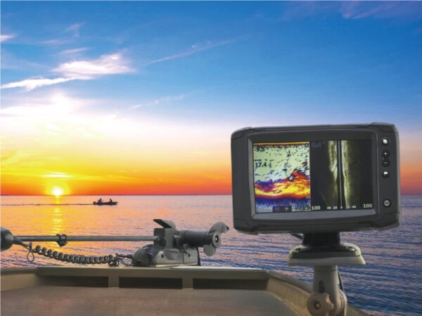
There are many different types of fish finders on the market, but they all have one common goal: to help you find fish. A fish finder uses sonar technology to detect fish in the water and then displays that information on a screen so you can see where the fish are and target them more effectively.
Fish finders come in a variety of shapes and sizes, but most have a transducer that emits sound waves into the water and a receiver that picks up these waves as they bounce back off of objects in the water. The time it takes for these waves to return is used to calculate the distance to the object, and this information is then displayed on the screen.
The type of Display will determine how easy or hard it is to interpret your findings. Some displays show simple dot representations of what is beneath your boat, while others use more advanced graphics to give you a better idea of bottom contours and other features. The important thing is to experiment with different settings until you find something that works for you.
Most fish finders also include GPS capabilities these days, which can be used to mark fishing spots, create waypoints, and navigated back to shore. This can be a valuable feature if you’re exploring new waters or just want to make sure you can find your way home again!
Types of Fish Finders
There are many different types of fish finders on the market. Each has its own strengths and weaknesses, so it’s important to choose the right one for your needs.
Sonar fish finders use sound waves to detect fish. They send out a sound wave and then listen for the echo. The time it takes for the echo to return is used to calculate the depth of the water and the location of any fish. Sonar fish finders can be either portable or mounted on your boat. Portable units are great for kayak fishing or ice fishing, while mounted units are more suited for larger boats.
GPS fish finders use both GPS and sonar technology to help you find fish. The GPS part of the unit helps you pinpoint your location on a map, while the sonar part detects any nearby fish. GPS units are more expensive than regular sonar units, but they offer a lot more features and functionality. Some GPS units even come with built-in maps of popular fishing spots.
Side imaging fish finders create a detailed image of the area around your boat. They use high-frequency sound waves that penetrate deep into the water column, providing you with a clear picture of what’s below you. Side imaging units are ideal for finding structure or bottom contours that may hold fish. They’re also great for spotting schools of bait
How Do Fish Finders Work?
Fish finders work by using sonar technology. Sonar (short for sound navigation and ranging) is a technique that uses sound waves to detect objects in the water. A fish finder typically has transducers mounted on the bottom of the boat that emit sound pulses into the water. When these pulses encounter an object, like a fish, they reflect back to the transducer which then sends them to a display monitor on board. The display will usually show an image of what is beneath your boat, including any fish or other objects in the water.
Fish finders work by sending out a cone of sound waves into the water. As these waves bounce off of objects in the water, they are reflected back to the fish finder. The fish finder then uses these reflections to create a map of what is beneath the surface.
Fish finders can use either active or passive sonar. Active sonar emits a pulse of sound and then listens for the echoes that come back. This type of sonar is very good at finding fish, but it can be disruptive to other animals and humans in the area. Passive sonar simply listens for sounds that are already present in the water. This type of sonar is less likely to disturb other creatures, but it is not as effective at finding fish.
How to Read a Fish Finder Map
In order to read a fish finder map and find fishing spots, you need to understand the different elements that are represented on the map. The first thing to look for is the depth contours, which will show you the changes in depth along the bottom of the body of water you are fishing. These contours can help you identify areas where there are drop-offs or other changes in the bottom structure that could be holding fish. Another thing to look for on the map are underwater features like reefs, shipwrecks, or submerged vegetation. These features can provide cover and shelter for fish, making them good places to target. Finally, pay attention to where the baitfish are congregating on the map. Baitfish will often school up around structures or in areas with high concentrations of food, and predators will follow them. By locating these areas on your map, you can increase your chances of finding fish.
Tips for Using a Fish Finder
- Look for areas of high fish concentration. Fish finders use sonar to detect fish, so areas with a lot of fish will appear as large blips on the screen.
- Look for changes in bottom structure. Fish tend to congregate around areas of change in bottom structure, such as reefs, drop-offs, or shipwrecks. These areas will appear as sudden changes in depth on the fish finder map.
- Look for areas of baitfish concentration. Baitfish are small fish that schools of larger fish feed on. Areas with a lot of baitfish will appear as small dots on the screen.
- Look for temperature breaks. Water temperature can vary depending on location and time of day. Fish tend to congregate in areas where there is a significant difference in water temperature (known as a “temperature break”). These areas will appear as different colors on the map
With a little practice, learning how to read fish finder maps is not that difficult. Whether you’re looking for an easy way to locate fishing spots or just trying to become the captain of your own boat, this article has certainly given you some useful knowledge on how to interpret these maps and make your time out in the water more productive. So grab your gear and put your newfound skills into action today!